
The Yucatán Peninsula: A Complete Travel Guide
The Yucatán is the part of Mexico most people are picturing when they picture Mexico: pyramids in the jungle, flooded limestone caves you can swim in, low colonial cities the color of ochre and mango, and a Caribbean coast that runs from Cancún down to a lake with seven shades of blue. It is also the easiest region in the country to travel — flat, well-paved, heavily set up for visitors, and safe by Mexican standards.
That combination is why almost every guide tells first-time visitors to start here, and this one does too. What follows is what the peninsula actually is, how its three states differ, why it works so well as a first trip, and — the part most guides skip — how to plan around the crowds instead of straight into them. For where the Yucatán fits in a longer Mexico trip, see the open-ended Mexico itinerary, which breaks the country into eight regions.
Key Takeaways
The Yucatán Peninsula covers three Mexican states: Yucatán (Mérida, Valladolid, Chichén Itzá), Quintana Roo (Cancún, Playa del Carmen, Tulum, Bacalar, Holbox), and Campeche (quiet, colonial, largely skipped).
It is the lowest-friction region in Mexico for a first trip: short distances, first-class buses, the new Maya Train, and no altitude or hard terrain.
Yucatán state and Campeche both sit at the lowest U.S. travel-advisory level (Level 1); Quintana Roo is at Level 2, "exercise increased caution" (U.S. Department of State)
You cannot climb the main pyramid at Chichén Itzá or the structures at Tulum. You can still climb at Ek Balam and Cobá.
Sargassum (Caribbean seaweed) is heaviest May to August and cleanest November to April, and it mainly hits the open coast around Tulum and Playa del Carmen — not the cenotes, not Bacalar, not the north coast (University of South Florida).
The single biggest upgrade to a Yucatán trip is basing in Valladolid instead of Tulum, visiting Bacalar on a weekday, and choosing the quiet cenotes over the famous ones.
A week does one corner properly; two weeks does the classic loop; three weeks adds Mérida, Campeche, and an island.
What Is the Yucatán Peninsula?
The Yucatán Peninsula is the thumb of land that separates the Gulf of Mexico from the Caribbean Sea, and for a traveler it comes down to four things: cenotes, ruins, colonial towns, and the Caribbean coast.
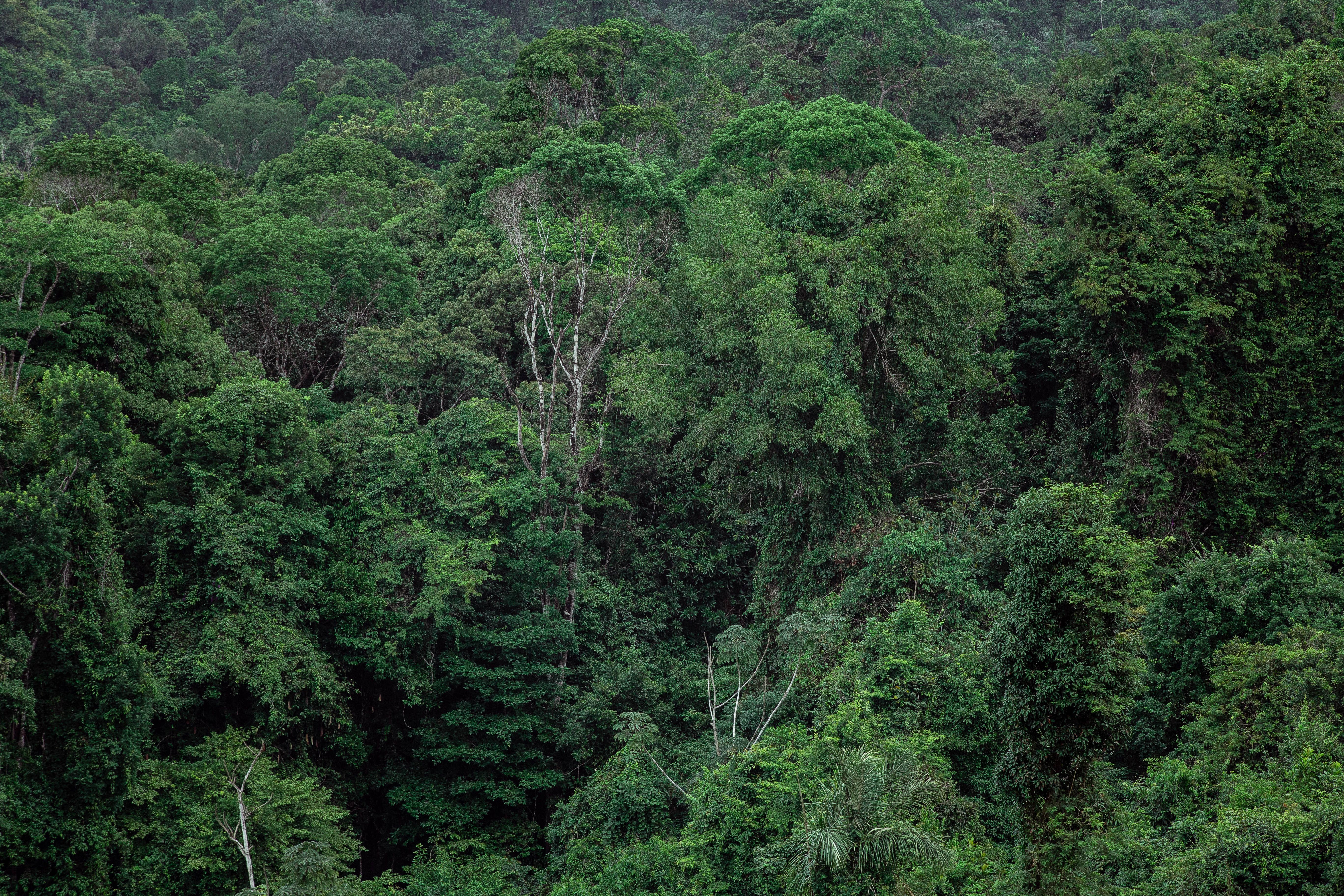
Cenotes are the defining feature. The whole peninsula is a slab of porous limestone with no surface rivers — the rain drains straight down into an enormous network of flooded caves and sinkholes. Where the rock roof has collapsed, you get a cenote: a pool of cool, clear groundwater, sometimes open to the sky like a swimming hole, sometimes a cathedral-sized cavern hung with stalactites. The Maya considered them sacred entrances to the underworld. There are thousands, and swimming in them is the single most Yucatán thing you can do. Start with the Yucatán cenotes guide for which ones are worth the drive and which are overrated.
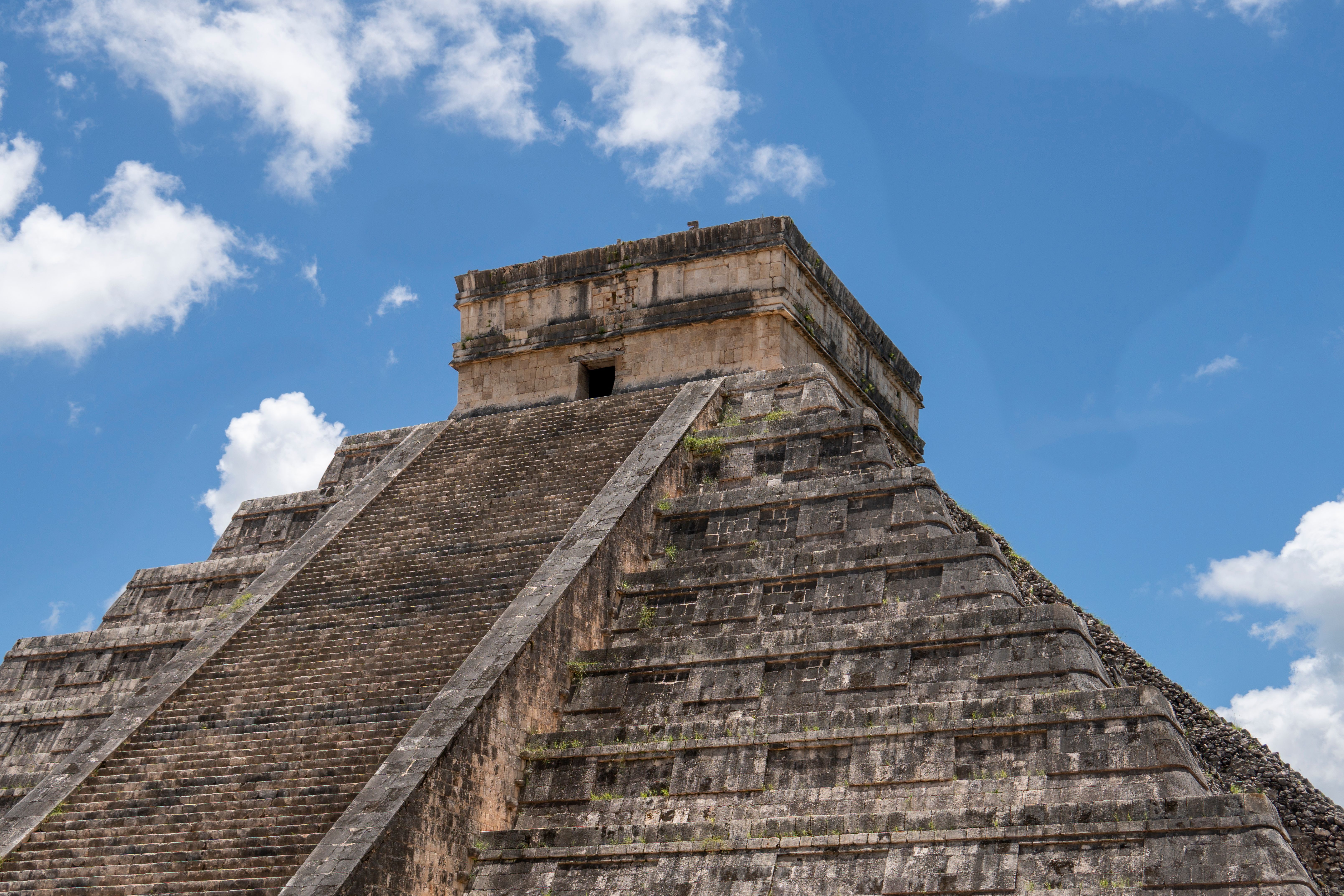
Ruins. This was the heart of the Maya world, and it still is — Chichén Itzá, Uxmal, Ek Balam, Cobá, Tulum, Mayapán, plus dozens of smaller sites you can have nearly to yourself. Chichén Itzá is one of the New Seven Wonders of the World and gets the crowds to match; the Chichén Itzá visitor guide covers timing, tickets, and how to see it without the tour-bus scrum.
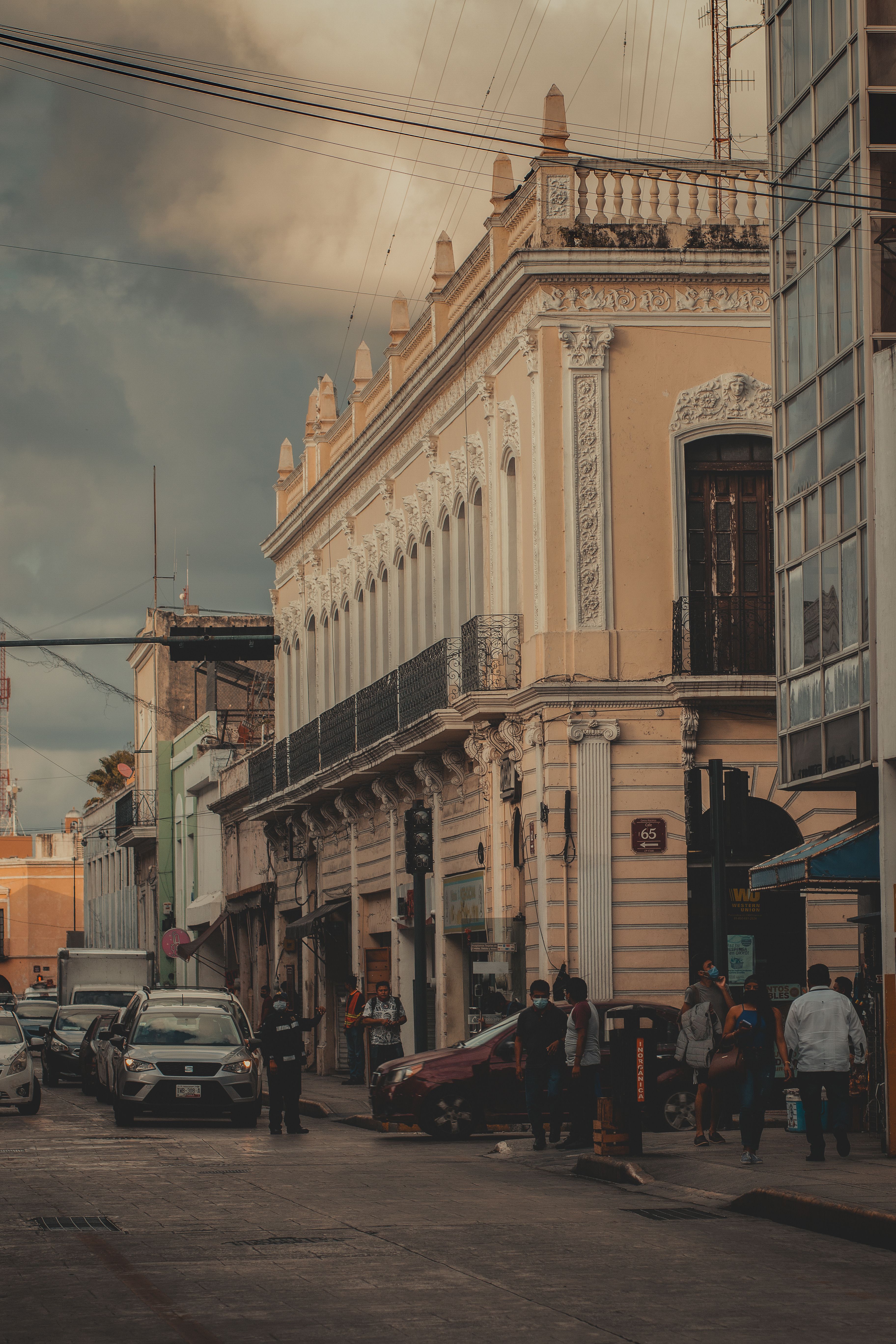
Colonial towns. After the conquest, the Spanish built low stone cities on top of Maya ones — Mérida, Valladolid, Campeche, Izamal — with arcaded plazas, single-story houses in saturated colors, and a cathedral on the square. They are walkable, cheap, full of good food, and a complete change of pace from the coast.
The Caribbean coast. The entire eastern edge, all of it in Quintana Roo, is white sand and turquoise water: Cancún's hotel strip, Playa del Carmen, Tulum, the island of Cozumel, Holbox and Isla Mujeres to the north, and Bacalar's freshwater lagoon near the Belize border. This is the busy, developed, expensive part of the peninsula, and also the reason most flights land here.
Yucatán State vs Quintana Roo vs Campeche
The peninsula is three states, and knowing which is which saves you a lot of confusion when you read about safety, weather, or the Maya Train.
Yucatán state is the northwest: Mérida (the capital), Valladolid, Izamal, Chichén Itzá, Uxmal, the flamingo coast at Las Coloradas and Celestún, and most of the best inland cenotes. It has a short stretch of Gulf coast — Progreso — but no Caribbean beaches. This is the colonial-towns-and-ruins half of a trip, and it is calm, inexpensive, and low-key. It carries the lowest U.S. travel-advisory rating in the country (U.S. Department of State).
Quintana Roo is the entire Caribbean side: Cancún, the Riviera Maya (Puerto Morelos, Playa del Carmen, Akumal), Tulum, Cozumel, Isla Mujeres, Holbox, and — four hours south — Bacalar and the state capital Chetumal. This is where the resorts, the nightlife, the dive sites, and the prices are, and where nearly every international visitor lands. It sits at Level 2 on the U.S. advisory scale, "exercise increased caution," the same tier as most of central Mexico.
Campeche is the southwest, facing the Gulf: the walled city of San Francisco de Campeche, the vast Calakmul ruins deep in the jungle near the Guatemala border, and a lot of quiet coastline. Almost no one includes it, which is exactly its appeal. It is also Level 1 (U.S. Department of State).
If you only remember one thing: Quintana Roo is the beach, Yucatán is everything inland , Campeche is the part nobody visits.
Why the Yucatán Is the Easiest Place to Start in Mexico
The Yucatán is the region to pick for a first trip to Mexico because almost everything that makes travel elsewhere in the country harder is absent here.
The distances are short. Cancún to Valladolid is two hours; Valladolid to Mérida is another two; Cancún to Tulum is two. You can see a lot without a single long travel day. The land is flat, so there is no altitude to adjust to and no mountain roads. The tourism infrastructure is the densest in Mexico — ADO first-class buses connect every town on a schedule you can rely on, the Maya Train now runs across the whole peninsula, and there are hostels, mid-range hotels, and English-speaking tour desks in every base town.
Safety is a genuine part of it. Two of the three states are at the lowest advisory level, and the Yucatán safety guide breaks down what the numbers actually mean for a visitor. Mérida is regularly cited as one of the safest cities in Mexico. The real risks for tourists here are ordinary ones — taxi overcharging, ATM skimming, petty theft, dehydration, and rip currents — not the ones that make headlines.
None of this is a reason to treat the region as a theme park. It is a reason to arrive with a plan instead of a package, because the low friction that makes the Yucatán easy also makes it very easy to spend a week seeing only the parts that everyone else sees.
Get Off the Circuit: The Case for the Quiet Version
The Yucatán has a standard backpacker-and-cruise circuit — Cancún, Playa del Carmen, Tulum, one photogenic cenote, Chichén Itzá on a day tour, maybe Bacalar — and it is the least interesting version of the region. The whole peninsula reads like a generic itinerary unless you deliberately step off it.
Three specific swaps do most of the work.
Base in Valladolid, not Tulum. Valladolid is a real colonial town in the center of the peninsula, 40 minutes from Chichén Itzá, surrounded by cenotes, with good food, low prices, and a fraction of the crowds. Tulum is expensive, spread out, sargassum-prone in summer, and increasingly a scene rather than a place. From Valladolid you can day-trip to Chichén Itzá, Ek Balam, the flamingos at Río Lagartos, and half a dozen cenotes; the Valladolid travel guide and the day trips from Valladolid post lay out the options.
Do Bacalar on a weekday. Bacalar's lagoon is calmest and emptiest early on a weekday morning, before the wind picks up and before the weekend crowd arrives from Chetumal and Cancún. Same lake, completely different experience. See things to do in Bacalar and the live Bacalar travel guide.
Choose the quiet cenotes. The famous ones — the photo platform at Suytún, Ik Kil next to Chichén Itzá — are packed by mid-morning and often more about the picture than the swim. Drive 20 minutes further and you can have a better cenote nearly to yourself. The best cenotes near Valladolid guide sorts them out.
The Yucatán Region by Region
Here is the whole peninsula, broken into the bases people actually use, with a pointer to the detailed guide for each.
Valladolid and the Interior
Valladolid is the smartest single base in the region — central, cheap, walkable, and within a short drive of Chichén Itzá, Ek Balam, three or four excellent cenotes, and the pink lakes and flamingos of the north coast. Two to three nights here covers more headline sights than anywhere else on the peninsula. Full detail in the Valladolid travel guide.
Mérida and the West
Mérida is the peninsula's cultural capital: a mid-sized colonial city with free nightly music and dance in the plazas, some of Mexico's best regional food (cochinita pibil, sopa de lima, marquesitas), and a calm, safe, lived-in feel. It is the base for Uxmal and the Puuc Route ruins, the Celestún and Progreso coast, the yellow town of Izamal, and the Homún cenote cluster. It is also a Maya Train hub. Give it three or four nights; the Mérida travel guide covers neighborhoods, timing, and day trips.
Chichén Itzá, Ek Balam and the Ruins
Chichén Itzá is the one nearly everyone sees, and it earns the visit — but you cannot climb El Castillo (roped off since the mid-2000s), it is busy by 10 a.m., and the interior paths run a gauntlet of souvenir vendors. Arrive at opening from Valladolid, or take the Maya Train, which now has a station serving the site. The combined federal and state entry fee for foreigners is on the order of 650 to 700 pesos.
For a ruin you can still climb, and far fewer people, go to Ek Balam (30 minutes from Valladolid) or Cobá (between Tulum and Valladolid). Uxmal, near Mérida, rivals Chichén Itzá for architecture and gets a fraction of the traffic. The Chichén Itzá visitor guide covers the whole ruins question — which sites, in what order, and whether to hire a guide.
Cenotes
Every base has its cenotes. Valladolid has the densest cluster; Tulum has the well-known cave systems (Dos Ojos, Gran Cenote, Calavera); Mérida has the Homún and Cuzamá routes; Playa del Carmen has roadside cenotes 15 minutes out of town. The rules are the same everywhere: shower before you get in, wear only biodegradable sunscreen or none at all (many ban all of it), and expect a life jacket to be compulsory. The Yucatán cenotes guide ranks them and explains how to beat the crowds.
Cancún
Cancún is the entry point — the airport handles the bulk of flights to the peninsula — and it is two different places. The Hotel Zone is a 22-kilometer barrier island of all-inclusive resorts. Downtown (El Centro) is a normal Mexican city with markets, cheap food, and local buses. You do not have to stay in the Hotel Zone to enjoy Cancún, and the Cancún travel guide makes the case for looking beyond it. Note that there are no ride-share pickups at the airport; use the official ADO buses or a pre-booked shuttle.
Playa del Carmen and the Riviera Maya
Playa del Carmen is the walkable middle option on the coast — cheaper than Tulum, more compact than Cancún, with a pedestrian avenue, a ferry to Cozumel, and cenotes and eco-parks close by. It works well as a base for the Riviera Maya if you want the beach without the resort bubble or the Tulum prices. See the Playa del Carmen travel guide.
Tulum
Tulum is the clifftop ruins, the cenotes inland, the Sian Ka'an biosphere to the south, and a long beach road of design hotels that has become the region's most polarizing destination. It is genuinely beautiful and genuinely overpriced, and in summer the open beach gets the worst of the sargassum. Entry to the ruins now runs through a national park (the Jaguar Park) with a revised access and fee setup. The things to do in Tulum post and the live Tulum travel guide cover it honestly, including who Tulum is and isn't for.
Bacalar
Bacalar sits near the Belize border on a freshwater lagoon nicknamed the Lake of Seven Colors, and it is the calm counterpoint to the coast: no sargassum, no big resorts, a small colonial fort, cenotes on the lakeshore, and dawn kayaking before the wind. It is about four hours south of Tulum by bus or Maya Train. Weekdays are much quieter than weekends. Start with things to do in Bacalar and the live Bacalar travel guide.
Holbox and the North Coast
Holbox is a car-free sandbar island on the north edge of the peninsula, inside the Yum Balam reserve: golf carts, sandy streets, shallow turquoise water, flamingos, whale sharks from June to mid-September, and bioluminescence on new-moon nights. You reach it by a short ferry from Chiquilá, itself a couple of hours from Cancún. It is not cheap and it is not undiscovered anymore, but it is a genuinely different pace. See the Isla Holbox travel guide and the Holbox–Chiquilá ferry guide.
Campeche
Campeche is the state most travelers never reach: a UNESCO-listed walled city with pastel streets and sea walls, the enormous jungle-buried ruins of Calakmul (a rival to Tikal, with far fewer visitors), and a slow Gulf coast. It is on the Maya Train between Mérida and Palenque. Add it if you have three weeks or you want the peninsula without the crowds.
Planning the Basics
Each of these has a dedicated guide; this is the short version.
How Many Days Do You Need?
One week does one corner of the peninsula properly — either Valladolid plus Chichén Itzá plus a couple of cenotes, or a stretch of the coast. Ten days lets you link the interior and the coast. Two weeks covers the classic loop: Cancún, Valladolid, Chichén Itzá, Mérida, Bacalar or Tulum. Three weeks adds Campeche, Uxmal, and an island. The Yucatán itinerary guide has route-by-route breakdowns for each length and each transport style.
When to Go
The dry season, roughly November to April, is the reliable window — warm, sunny, low humidity, and the least sargassum on the Caribbean. May to October is hotter and wetter, with the heaviest rain and the hurricane risk concentrated from August into October. The shoulder months of November and April tend to give you dry-season weather with lower prices. Sargassum peaks May to August. Whale-shark season off Holbox and Isla Mujeres runs mid-June to mid-September. Flamingos are best on the Yucatán coast from about March to June. The best time to visit the Yucatán guide has a month-by-month table.
Is the Yucatán Safe?
By Mexican standards, yes. Yucatán state and Campeche are at Level 1, the lowest U.S. advisory tier; Quintana Roo is at Level 2, "exercise increased caution" (U.S. Department of State). Isolated violent incidents in the Tulum and Playa del Carmen nightlife scene have made the news in recent years; they have generally not targeted tourists and have been concentrated in the drug trade. The practical risks for a visitor are petty theft, taxi and ATM scams, heat, and rip currents. The Yucatán safety guide keeps a dated, tier-1-sourced breakdown.
Getting Around
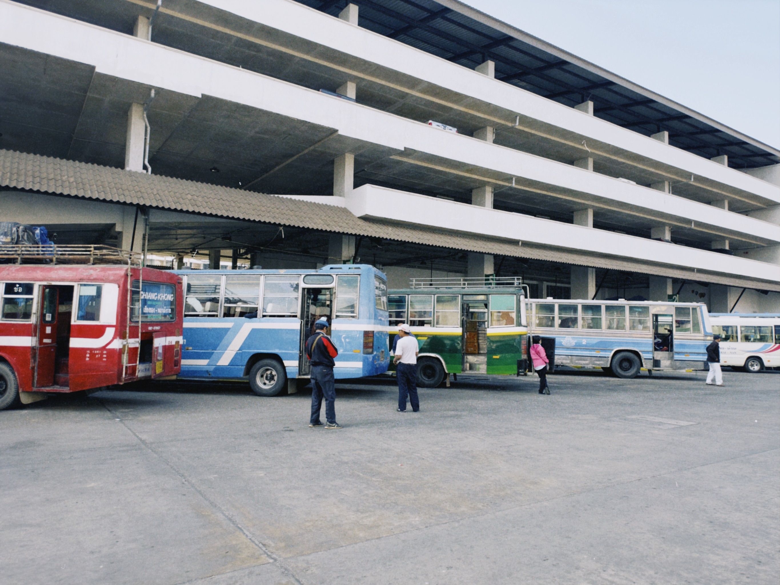
You have four options: rent a car (the most flexible, but watch the mandatory-insurance upsell at the counter), ride ADO first-class buses between towns (comfortable, punctual, cheap), take colectivos for short hops, or use the Maya Train. Many people do the Yucatán with no car at all and only rent one for a day or two of cenote-hopping. The getting around the Yucatán guide gives a verdict by trip type.
The Maya Train
The Maya Train (Tren Maya) is the federal railway that opened in stages from 2023: about 1,554 kilometers and roughly 34 stations in a loop connecting Palenque, Campeche, Mérida, Valladolid, Chichén Itzá, Cancún, Tulum, and Bacalar (Gobierno de México). Tickets are sold on the official site and at station kiosks. It is scenic and improving, but boarding is slower than a bus and several stations sit well outside town centers, so it is not automatically the fastest way between two points. The Maya Train guide covers fares by segment, how to book, and where it genuinely beats the bus.
Suggested Routes by Trip Length
One week, first trip, no car. Fly into Cancún, bus straight to Valladolid (skip Cancún itself). Three nights in Valladolid: Chichén Itzá at opening, Ek Balam and a cenote, the Río Lagartos flamingos. Two nights in Mérida for the city and Uxmal. Bus back to Cancún for the flight. This is the highest-payoff week on the peninsula and it never touches the Riviera Maya.
Ten days, interior plus coast. The week above, then instead of returning to Cancún, continue from Mérida or Valladolid down to Bacalar for three nights on the lagoon. Fly out of Chetumal or bus back up the coast.
Two weeks, the classic loop. Cancún (one night or none) → Valladolid (3) → Mérida (3) → Campeche (2) → back east to Bacalar (3) → Tulum or Playa del Carmen (2) → Cancún. Do it by bus, by car, or by Maya Train.
Three weeks. The loop above at a slower pace, plus Holbox (3 nights) before or after Cancún, plus Uxmal and the Puuc Route as an overnight from Mérida, plus a Calakmul trip from Campeche or Bacalar.
For the version of any of these built around a specific transport mode — car, ADO, or the train — see the Yucatán itinerary guide
Frequently Asked Questions
Is the Yucatán the same as Cancún and the Riviera Maya?
No. Cancún, Playa del Carmen, and Tulum are all in the state of Quintana Roo, which is only the eastern, Caribbean edge of the peninsula. The Yucatán Peninsula also includes Yucatán state (Mérida, Valladolid, Chichén Itzá) and Campeche. People often say "the Yucatán" to mean the whole peninsula and "Yucatán" to mean just the state — context usually makes it clear.
Can you climb the pyramids at Chichén Itzá?
No. Climbing El Castillo, the main pyramid at Chichén Itzá, has been prohibited since the mid-2000s, and the structures at Tulum are also roped off. If climbing a pyramid matters to you, go to Ek Balam or Cobá, where it is still allowed, or Uxmal, where the largest structures are roped but the site is far quieter than Chichén Itzá.
How bad is the sargassum, and where can you avoid it?
Sargassum seaweed washes up on the open Caribbean coast, heaviest from about May to August and lightest from November to April, and 2026 has been forecast as a heavy year (University of South Florida). Tulum and the beaches south of Playa del Carmen get the worst of it. It does not affect the cenotes, Bacalar's freshwater lagoon, or the north-coast beaches around Holbox and Isla Mujeres, so those are the reliable places to swim in summer.
Do you need a car in the Yucatán?
Not necessarily. ADO first-class buses and the Maya Train connect every town, and a lot of travelers see the whole region without renting a car. A car mainly helps for cenote-hopping and reaching sites that buses do not serve directly; some people rent one for just a day or two out of Valladolid or Mérida.
Is Valladolid or Tulum the better base?
Valladolid, for most trips. It is central, much cheaper, walkable, has no sargassum, and puts Chichén Itzá, Ek Balam, the flamingos, and a cluster of cenotes within day-trip range. Tulum is better only if the beach and the coastal scene are the point of your trip.
The Bottom Line
The Yucatán is the right place to start in Mexico: short distances, good buses, real safety, and a payoff — cenotes, ruins, colonial cities, Caribbean water — that is out of proportion to the effort. The one decision that shapes the trip is whether you take the standard circuit or step off it. Base inland, travel midweek where you can, drive past the first cenote to the second one, and give Mérida and Campeche the time the coast usually eats. For the wider country beyond the peninsula, pick up the open-ended Mexico itinerary and its eight regions.