The Ultimate Open-Ended Itinerary for Mexico Travel
Every Mexico itinerary online hands you someone else's schedule. Ten days, these exact stops, this order. It works right up until your dates don't match the plan — and then you're either cutting a region that mattered to you or rushing a place that deserved a week.
This guide does it differently. Instead of one fixed route, it breaks Mexico into eight regions, each with its own character, so you can combine them to fit the time you actually have. I've ridden a motorcycle through every one of Mexico's 32 states — not a single three-month pass, but years of living here and covering the country state by state. What follows is how I'd actually plan a trip.
Key Takeaways
Mexico has 32 federal entities (31 states + Mexico City) spread across nearly 2 million km². "How long do I need?" has no single answer — it depends which regions you pick.
Rule of thumb: 1–2 regions for a week, 2–3 for two weeks, 3–4 for a month. Don't try to see the whole country in one trip. Nobody does.
Start here if it's your first time: Yucatán (easy, safe, high payoff) or Chiapas (deeper, wilder, more effort).
This site covers Chiapas and the Yucatán in depth, Oaxaca in full, and Copper Canyon as a researched guide. The Pacific Coast states, Baja, the Central Highlands and the Northeast are being built out — honest about that below.
Below the framework is the actual overland loop I run — around 25 stops from the Caribbean to the northern desert, in seven phases, built to work on a motorcycle, in a rig, or by bus and train, and to come apart if you only have time for one piece.
Works for backpackers and for riders. Where it matters, I've pointed to the bus-and-collectivo version and the motorcycle version separately.
Some links in this post are affiliate links: at no cost to you, I earn a small commission if you buy through them. More here.
How to Use This Guide (It's Not Another Fixed Itinerary)
The short version: pick your regions first, then figure out days — not the other way round.
Mexico took a record 98.2 million international visitors in 2025 — up 13.6% year on year, of which 47.8 million were overnight tourists (Mexico Business News). And the country is co-hosting the 2026 FIFA World Cup with the USA and Canada, with roughly 5.5 million extra visitors expected around the June–July tournament (Mexico Business News). A lot of people are planning this trip right now, and most start from the wrong end — a day count instead of a shortlist of regions.
The country is the world's 13th largest at 1,972,550 km², with over 9,330 km of coastline on three different seas (CIA World Factbook: Mexico) Chihuahua alone (~247,000 km²) is bigger than the United Kingdom. The regions aren't a formality — a jungle-and-ruins trip through the south and a desert-and-surf run down Baja have almost nothing in common except the passport stamp.
How to combine them:
The 8 regions at a glance
The Route I Actually Run
The eight regions above are the menu. This is the meal — the specific overland loop I run through Mexico and recommend to everyone, whether you're on a motorcycle, driving a rig, or moving by bus and train.
It starts on the Caribbean, drags you through the southern jungle, up into the mountains where the food turns to slow-roasted meat and raw agave, and finishes in the northern desert. It deliberately skips the sanitized resort zones and points you at the local version of every stop. Do the whole thing on an open-ended ticket, or take one phase and fly home — it's built to come apart.
How the three modes ride this route
Motorcycle — this is how the route is built. The riding highlights are the Highway 199 run into Palenque, the climb up to San Cristóbal, the Sierra crossing down to the Oaxaca coast, and the one-lane Ogarrio tunnel into Real de Catorce. You park the bike for Phase 7 and take the train.
Van / 4x4 overlander — the spine is all paved highway and fine for a big rig: Highway 307 down the Yucatán, 199 and 190 through Chiapas, 175/135 through Oaxaca, the Bajío toll roads, Highway 15D up the Pacific. Three pinch points: the historic centers of San Cristóbal and Guanajuato (park on the edge, walk in), and the Ogarrio tunnel into Real de Catorce — too low and narrow for most rigs; leave the vehicle down in the valley at Estación Catorce and ride a shared Willys up. The places named below are backpacker hostels with street parking only — check iOverlander for secure lots in each town.
Backpacker (bus + train) — every leg is an ADO or a second-class bus. You only need your own wheels twice: a scooter in Valladolid for the cenote route, and a rental car in San Luis Potosí for the Huasteca Potosina. Phase 7 is the El Chepe train no matter how you got there.
Phase 1 — The Yucatán Peninsula
Land at Cancún and get off the paved, overpriced tourist corridor as fast as humanly possible.
Cancún — the escape. Don't sleep here. Walk past the timeshare sharks screaming your name at the airport exit, find the red ADO bus booth, and buy a ticket out immediately.
El Cuyo. Stay: Lunarena Boutique, or negotiate a cheap beach cabaña on arrival — you don't need fast Wi-Fi here. Do: the wind is aggressive; rent a kiteboard and get thrown around the Gulf of Mexico. Find the dirt-floor spots serving fish caught two hours ago and skip Tulum prices.
Valladolid — the staging ground. Stay: Treebu Hostel, the smartest logistical base in the state. Do: rent a scooter from Treebu Experience and ride to Cenote Sac-Aua for 9:00 AM flat — swim around the natural island before the tour buses land. Map the rest of your water route with the Valladolid travel guide.
Bacalar. Stay: The Yak Lake House — right on the water without destroying your budget. Do: cheap kayak at 6:00 AM while the lagoon is dead quiet and the booze cruises are still asleep. Buy a heavy, Nutella-stuffed marquesita from a street cart in the square at night. Full detail: the Bacalar travel guide
Phase 2 — The Deep South & the Highlands
The long, heavy driving day where the casual vacationers completely tap out. You leave the flat peninsula for the brutal elements of the south.
Palenque. Stay: Kin Balam Cabañas — sleep in the jungle and hear the howler monkeys. Do: be sweating through your shirt at the ruins by 8:00 AM, then ride out to the Roberto Barrios cascades to wash the humidity off. See the Palenque guide
San Cristóbal de las Casas. Stay: Puerta Vieja Hostel — you want thick walls, because the altitude drop will freeze you out at night. Do: skip the big bus tours and go with Mayab Experiences for a raw look at Tzotzil culture in Zinacantán and Chamula — learn a few words of Tzotzil first, it goes a long way. Take a shot of Pox, the local ceremonial liquor. Start with the full Chiapas overlanding guide and the Highway 199 safety guide
Phase 3 — Heavy Meat and the Pacific Coast
You drop out of the mountains into states entirely fueled by slow-roasted meat, agave, and fresh seafood. This is exactly where diets go to die.
La Crucecita / Huatulco. Stay: Hostal Azul y Blanco — cheap and functional. Do: take a handful of cash to the marina and hire a local fisherman to drop you at Bahía Cacaluta — no roads, just empty sand. Eat street tlayudas off a plastic plate at 1:00 AM.
Oaxaca City. Stay: Casa Angel — clean, cheap, right in the middle of the chaos. Do: walk into the Pasillo de Humo ("smoke alley") at Mercado 20 de Noviembre and buy a tray of raw beef to have grilled in front of your face. Hire a driver out to the dirt-road mezcal farms and taste the agave straight from the source. The whole state gets the full treatment in the Oaxaca section below.
Phase 4 — Volcanoes and Coffee
Point your wheels back toward the center of the country. The air gets thin again and the food gets incredibly heavy.
Puebla. Stay: Hostal Santo Domingo. Do: cheap ticket, a massive michelada, and scream your lungs out at a lucha libre match at Arena Puebla. Find a tiny fonda and order authentic mole poblano.
Mexico City. Worth the stop even on a route built to dodge the big cities — and if you're flying home rather than riding out the northern border, this is your natural exit point (see the end of this section).
Xalapa *(optional detour east of Puebla).* Stay: Casa de las Flores. Do: you're in the heart of Veracruz coffee country — sit in a café and drink a heavy black pour-over grown just up the mountain. Go look at the massive ancient Olmec stone heads at the Museo de Antropología.
Phase 5 — The Colonial Hearth
The center of the country is dense, loud, and moves at a breakneck speed — a maze of cobblestones and subterranean tunnels.
Santiago de Querétaro. Stay: El Hostalito. Do: walk the massive stone aqueduct arches. Find a dingy corner cantina, order a cheap beer, and eat whatever free botanas they slam down on the table.
San Miguel de Allende. Stay: Lool Beh Hostal. Do: ignore the overpriced fusion restaurants catering to Americans and find a street cart doing heavy carnitas tacos off the main square.
San Luis Potosí. Stay: Sukha Hostel. Do: rent a car and drive out to the terrifyingly blue waterfalls of the Huasteca Potosina. Jump off the cliffs if you want to test your insurance policy.
Real de Catorce. Stay: Hotel El Real — you're sleeping in a high-desert ghost town. Do: ride straight through the dark one-lane Ogarrio tunnel just to reach the town, then pay a local guide to take you into the desert on horseback.
León. Stay: Hostal San Isidro. Do: buy a heavy pair of leather boots in the markets. Eat a guacamaya — an aggressive street sandwich of a hard roll, big chunks of pork rind, and spicy salsa.
Guanajuato. Stay: Hostal Alonso. Do: get lost in the subterranean road tunnels, then climb the impossibly steep stairs to the Pípila monument at sunset.
Phase 6 — Tequila and the Pacific Highway North
Heading back toward the water, with heavy stops for tortas and pure agave.
Guadalajara. Stay: Hostal Hospedarte Centro. Do: eat a torta ahogada completely drowned in spicy red sauce to instantly clear your sinuses. Take a cheap bus out to the town of Tequila and drink the raw stuff in the main plaza.
Colima. Stay: Hostal La Parroquia. Do: drink a beer while looking at the highly active Volcán de Fuego de Colima. Eat sopitos loaded with ground meat and aggressive salsa from a local cart.
Manzanillo. Stay: Hotel La Posada. Do: skip the tourist zones in this heavy industrial port; eat insanely fresh ceviche on the malecón while the massive cargo ships come in.
Puerto Vallarta. Stay: Ten to Ten Hostel. Do: avoid the all-inclusive hotel zone at all costs. Hike back into the jungle to find the Palo María waterfalls, and eat standing up at the late-night al pastor spits on the street corners.
Santa Cruz de Miramar *(Nayarit).* Stay: negotiate a cheap local surf shack on arrival. Do: grab a board and hit the completely unpretentious, gritty surf break. Buy a dozen fresh oysters from a guy walking the beach with a bucket and a knife.
Mazatlán. Stay: Funky Monkey Hostel. Do: walk the massive sea wall at night — the city is loud and completely unapologetic. Eat raw shrimp aguachile cured in pure lime and crushed chilies until your face goes numb.
Phase 7 — The Final Stretch
Park the bike or step off the bus for a few days. You cut straight through the mountains to end the run.
Los Mochis. Stay: Hotel Fenix. Do: eat massive, heavy seafood cocktails packed with shrimp and octopus. Buy your physical ticket for the El Chepe Express.
Copper Canyon by rail → Chihuahua. Stay: Hostal Cuilty. Do: book the route through the official El Chepe site, then sit in the dining car with a cold beer and watch the massive, sheer drops of the Barrancas del Cobre roll past the window. It's a slow, heavy, industrial ride. Full breakdown: the El Chepe Express guide.
Monterrey. Stay: La Casa del Barrio. Do: order cabrito (roast kid goat) or massive cuts of beef — this is pure carnivore territory — then hike the saddle-shaped Cerro de la Silla to burn off the heavy meat sweats.
Where it starts and where it ends. Fly into Cancún for the cheap entry, not because you want to be there. The route ends in the north: Monterrey if you're riding out to Texas or you want the far north, or peel off at Guadalajara or Mazatlán and drop down to Mexico City to fly home if you're not. Everything between comes apart into phases — pick one, do it properly, come back for the next.
Chiapas & the Deep South
This is the deepest-covered region on the site, and where I actually live.
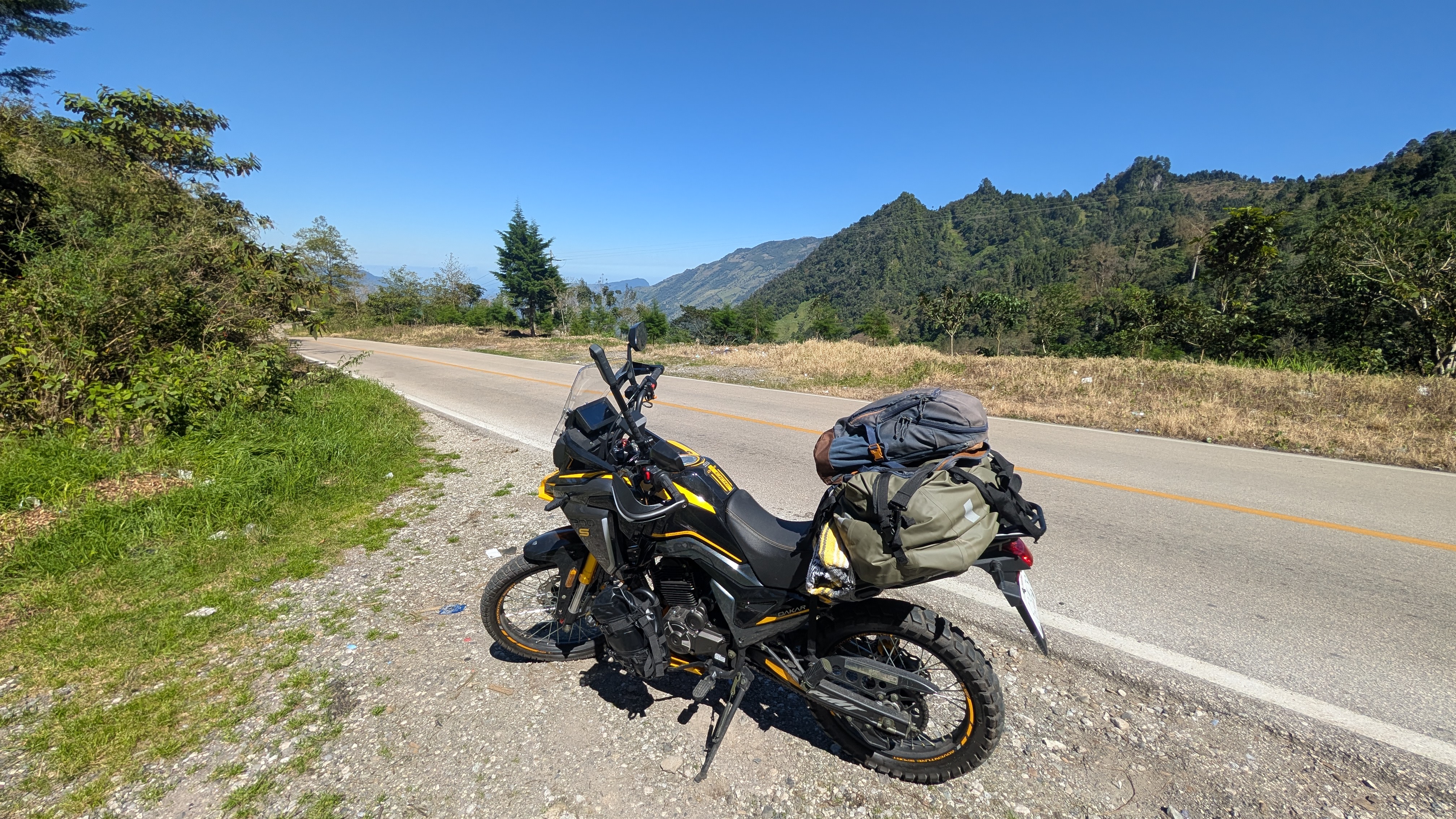
Chiapas is jungle, mountains, and the strongest indigenous culture in Mexico, packed into one state in the far south against the Guatemala border. Palenque's ruins still half-swallowed by rainforest. San Cristóbal de las Casas at 2,200 metres, cold at night, Tzotzil and Tzeltal Maya towns in the hills around it where the old religion never really left. The Sumidero Canyon. Waterfalls — Agua Azul, El Chiflón — that turn turquoise in the dry season. And Highway 199, the road between San Cristóbal and Palenque, which is one of the best rides in the country if you time it right and one of the more unpredictable if you don't.
It rewards time. A week is the minimum to do it properly; two weeks and you're getting into the parts most people never see — Toniná, the Lacandón jungle, the lakes at Montebello on the border.
Plan the whole thing: the full Chiapas overlanding guide and the unfiltered list of what's actually worth doing in Chiapas
Build the route: how many days you need in Chiapas
Before you go: is Chiapas safe in 2026 and the San Cristóbal–Palenque route and safety guide
Yucatán Peninsula
The counterpoint to Chiapas: flat, hot, and built around water.
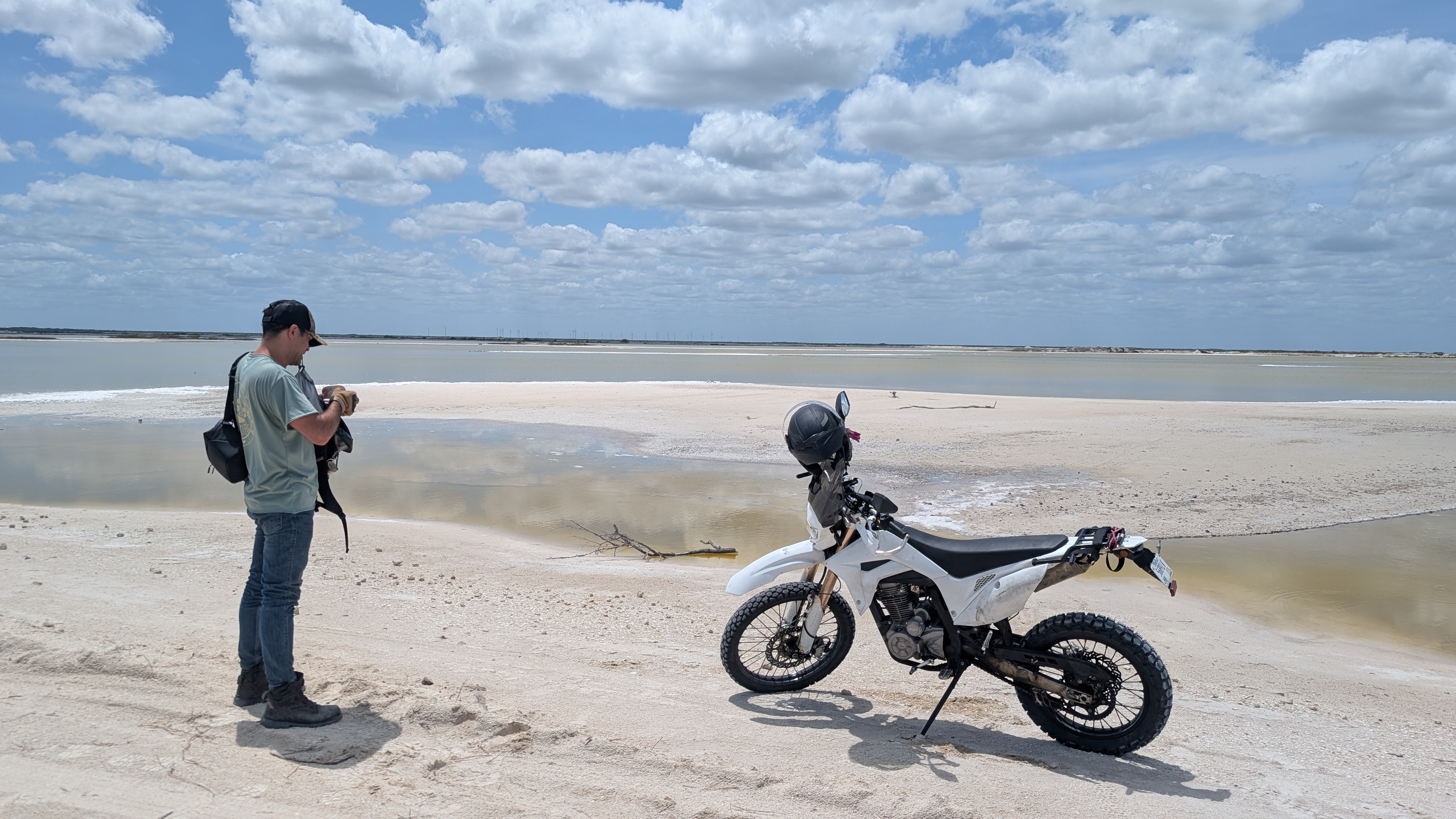
The Yucatán is cenotes — flooded limestone sinkholes you swim in — colonial towns like Valladolid and Mérida, the big-name ruins at Chichén Itzá and Uxmal, and the Caribbean coast from Tulum down to Bacalar's lake of seven colours. It's the easiest region in Mexico to travel: good roads, heavy tourism infrastructure, low friction. If it's your first trip to the country, start here.
The one gap in the plan is that the whole peninsula reads like a generic backpacker circuit unless you deliberately get off it — Valladolid instead of Tulum, the quiet cenotes instead of the Instagram ones, Bacalar on a weekday.
Yucatán hub: the Valladolid travel guide — the smartest base in the region
The coast: Tulum · Bacalar · the Holbox ferry
Still to come: Campeche state itself, and a dedicated Yucatán-by-motorcycle route
Oaxaca
The direct overland extension of Chiapas, and the first region heading up the Pacific.
Oaxaca is two trips in one state. Oaxaca City in the central valleys — mezcal, Monte Albán, the Zapotec artisan villages, some of the best food in Mexico — and the Pacific coast three or four hours south over the Sierra: Puerto Escondido's surf, the slow beach towns of Mazunte and Zipolite, the bioluminescent lagoon at Chacahua. The road that connects them, over the mountains through San José del Pacífico, is a ride in its own right.
Start here: the Oaxaca travel guide
The coast: best beaches in Oaxaca · Puerto Escondido · Mazunte vs. Zipolite vs. San Agustinillo
The valleys: things to do in Oaxaca City · the real mezcal route · how many days you need
Getting there: Chiapas to Oaxaca by motorcycle
Copper Canyon & the Sierra Madre
Canyon country in the northwest — bigger than the Grand Canyon, and most people see it from a train.
The Sierra Madre Occidental drops through Chihuahua, Sinaloa and Durango in a system of canyons collectively called the Copper Canyon (Barrancas del Cobre). The famous way through is the El Chepe railway from Los Mochis to Creel — one of the last passenger trains in Mexico and one of the great scenic rides anywhere.
The Pacific Coast Route: Chiapas to Nayarit
A single overland line up the west coast, south to north: Oaxaca → Guerrero → Michoacán → Colima → Jalisco → Nayarit.
This is the natural continuation of a Chiapas-and-Oaxaca trip — keep going north and you follow the Pacific for the better part of 1,500 km. I've ridden the whole route. The state-by-state write-ups are in progress; here's the shape of it and what each state is for. The northern half of this coast — Colima, Jalisco and Nayarit — is covered stop by stop in Phase 6 of the overland route above (my standard run cuts inland through the Bajío between Oaxaca and Guadalajara rather than taking the Guerrero–Michoacán coast road straight up).
Guerrero — the coast of Acapulco and the surf and fishing town of Zihuatanejo, plus the silver city of Taxco in the hills. The state carries a heavier security reputation than its neighbours; the coastal corridor and the main highways are the parts travelers use.
Michoacán — where the coast gets wild and empty: black-sand beaches, river-mouth breaks, tiny towns. Inland it's a completely different state — Pátzcuaro, the monarch butterfly reserves, Day of the Dead. One of the most beautiful states in the country and one of the most complicated.
Colima — small, quick to cross, dominated by its volcano. Manzanillo is the big port and beach town. Mostly a transit state on this route, but a pleasant one.
Jalisco — the heavyweight. Guadalajara (Mexico's second city), tequila country around the town of the same name, Lake Chapala, and the resort coast at Puerto Vallarta. This is where a coastal ride can turn into a week.
Nayarit — the northern end of this route: Sayulita, San Pancho, the Riviera Nayarit beach towns, and the crossing point toward Baja and the north. Laid-back, surf-oriented, the coast starting to feel like the desert north is close.
Baja California Peninsula
Mexico's iconic overland route: 1,700 km of Highway 1 down a desert peninsula with the sea on both sides.
Baja is its own thing. Cactus forests, whale lagoons at Guerrero Negro and San Ignacio, the Sea of Cortez, the wine country of the Valle de Guadalupe behind Ensenada, and the road itself — narrow, no shoulder, legendary. It's the most-searched uncovered region on this site and the route most overlanders put at the top of their list.
Central Highlands / Bajío
The colonial heartland: cities, food, and altitude instead of wilderness.
Mexico City, Puebla, and the Bajío towns — Guanajuato, San Miguel de Allende, Querétaro, Morelia — are a different kind of trip. This is where you come for architecture, museums, markets, and the country's deepest food culture, not for empty roads. Most itineraries anchor here because it's central and the transport links are excellent.
Northeast Border States
Mostly the way in. Nuevo León (Monterrey), Tamaulipas and Coahuila are the states riders cross coming south from Texas — or, if you're running the overland route the other direction, the way out. Monterrey has real mountains right behind it and closes out the route above (**Phase 7**: cabrito and the Cerro de la Silla hike). The border corridor itself is a get-through-efficiently zone rather than a destination, and this will be the thinnest section on the page for a while.
Frequently Asked Questions
How long do I need for a Mexico road trip?
There's no single number, and that's the point of this guide. Pick your regions first: one for a week, two for two weeks, three or four for a month. The full overland route on this page runs seven phases from the Caribbean to the northern desert — do the whole thing on an open-ended ticket, or take one or two phases and fly home. Trying to "see Mexico" in two weeks means seeing a sliver of it badly.
Is it safe to ride a motorcycle across Mexico?
Broadly yes, with the same caveats that apply to driving it: stick to main highways, move in daylight, don't improvise routes through areas you haven't checked, and pay attention to regional advisories — they vary a lot by state. The detailed version is in the Chiapas safety guide and the Route 199 breakdown, the general overland picture — paperwork, permits, borders — is in the full guide to motorcycle adventure travel
What's the best region to start with if I've never been to Mexico?
The Yucatán if you want easy and high-payoff — good roads, heavy infrastructure, cenotes and ruins and beaches with low friction. Chiapas if you want something wilder and you don't mind the trip being more effort. Both are covered in depth here, so you'd be arriving with a real plan.
Do I need a motorcycle, or can I do this by bus or car?
All of it works by bus and colectivo — the ADO bus network is excellent and most of the region guides here cover the no-vehicle version explicitly. A car gives you the cenote-hopping and beach-town freedom without the exposure of a bike. The motorcycle is for the road being the point, not just the transport.
Which region should I visit for the 2026 FIFA World Cup?
Mexico's host cities are Mexico City, Guadalajara and Monterrey — the Central Highlands, Jalisco, and the Northeast. If you're combining a match with a trip, Guadalajara puts you at the top of the Pacific Coast route; Mexico City is the gateway to the whole Bajío.
The Bottom Line
Eight regions, and you combine them to fit your time — not the other way round. If you want it as one line on a map, take the overland route above: fly into Cancún, work the seven phases up to the northern desert, and get off at whichever one your time or your patience runs out on. Right now this site covers Chiapas, the Yucatán, and Oaxaca in real depth, with Copper Canyon as a researched guide and the Pacific Coast, Baja, the Bajío and the Northeast being built out from rides I've already done.
If you're planning to ride the Chiapas or Yucatán regions yourself, Mayab Experiences rents motorcycles out of San Cristóbal. Otherwise: pick a region or a phase, open its guide, and start there. Check back as the rest go live.